Middle Peninsula
Virtual Heritage Tour
Urbanna Town
The New Towns Act of 1680 specified a site "in Middlesex County on the west side of Ralph Wormeley's Creeke against the plantation where he now lives." The town got off to a slow start due to the property owner's reluctance to sell the property for the town or courthouse. Most of the original lots were not conveyed until 1691. Most of the original streets were oriented towards Nimcock Creek (now Urbanna Creek). In 1705 the settlement was authorized by the legislature as Burgh of Urbanna, City of Anne.
Urbanna served as the County
Seat of Middlesex County between 1748 and 1851 when it was moved to Saluda.
The Town continues to thrive and, while, is much smaller geographically
than other Middle Peninsula Towns, is home to 543 people according to
the 2000 Census.
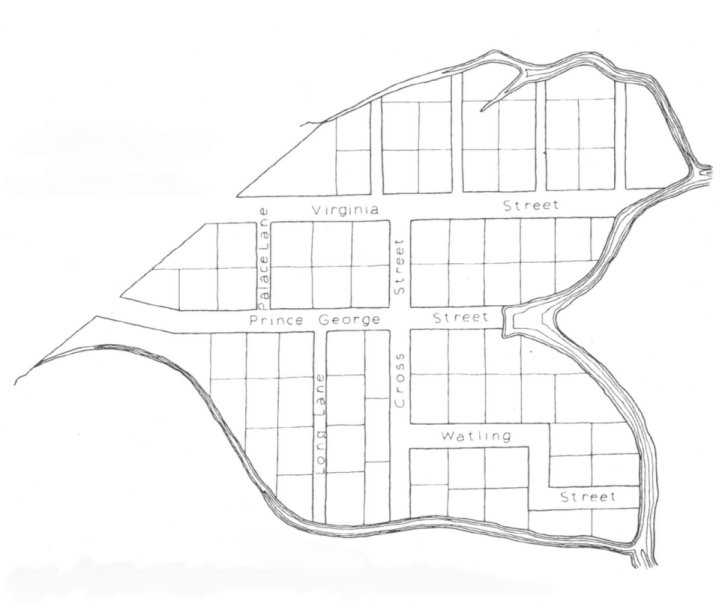
Plan of Urbanna, 1747
 1. Click to view clip showing Urbanna and Urbanna Creek area (3.1MB).
2. Click to view clip showing the Restored Tobacco Warehouse and the
Customs House (1.1 MB).
1. Click to view clip showing Urbanna and Urbanna Creek area (3.1MB).
2. Click to view clip showing the Restored Tobacco Warehouse and the
Customs House (1.1 MB).
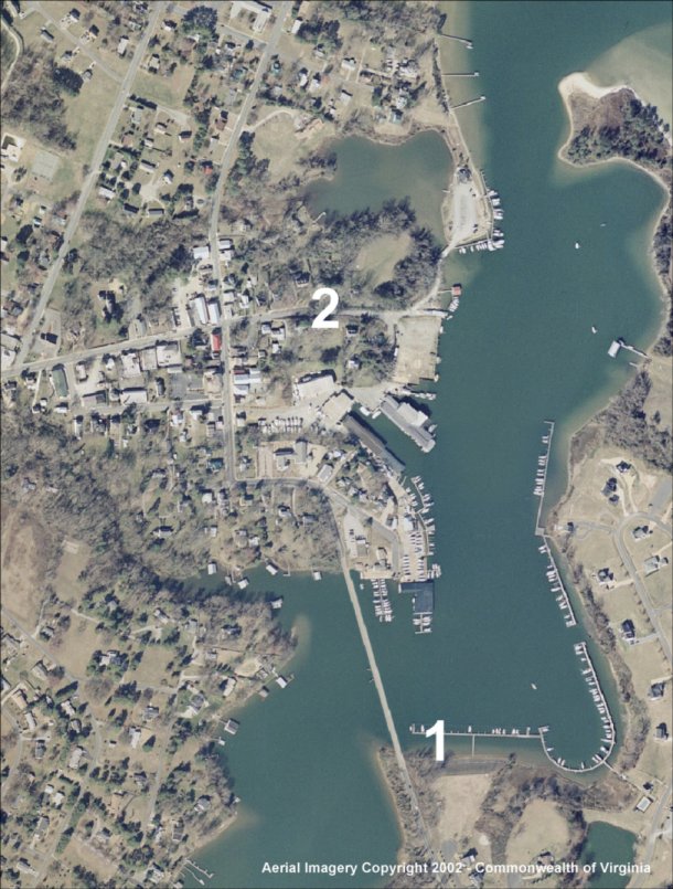
Area of Plan in Urbanna Today. Click on any symbol to view clip.
Created by The Middle Peninsula Planning District Commission, an agency sponsored cooperatively by Middle Peninsula Local Governments, the Commonwealth of Virginia, and the Federal Government.


MPPDC@mppdc.com
Middle Peninsula Planning District Commission
P.O. Box 286
Saluda, VA 23149-0286
804-758-2311
Updated June 2003