Middle Peninsula
Virtual Heritage Tour
New Point Comfort Lighthouse
New Point Comfort has played a role in three American wars. During the Revolutionary War the area was used to observe the British Navy. The British used the lighthouse during the War of 1812 for observation as well. During the Civil War the area was used at different times by Confederate and Union forces.
The 63 foot lighthouse was completed in 1805 at the tip of the New Point Comfort Peninsula in Mathews County to aid shipping traffic through the Chesapeake Bay towards Baltimore and Annapolis. A series of major storms in 1933 cut a channel through the peninsula, separating the lighthouse from the mainland. In 1963 the light was replaced by an offshore beacon and was abandoned until 1976 when restoration work was begun on the facility after it was acquired by Mathews County.

Plan of New Point Comfort Corporation, 1904
![]() Click to view clip of New Point Comfort area and Lighthouse
Click to view clip of New Point Comfort area and Lighthouse
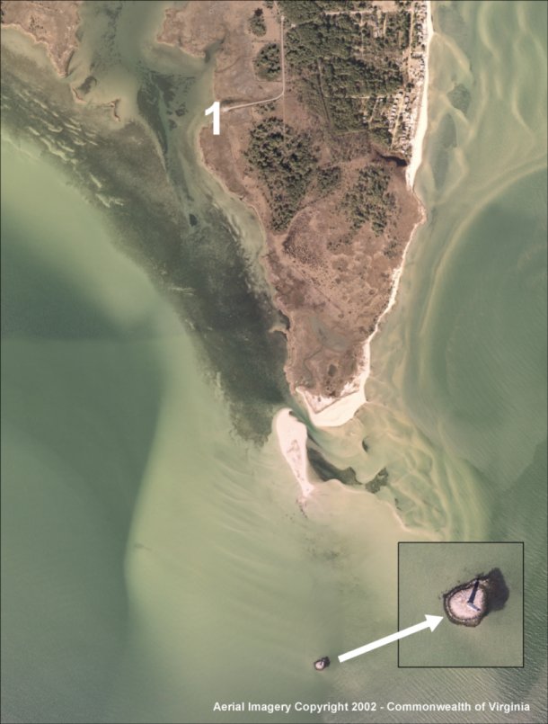
Area of Plan Today. Click on symbol to view clip.
Created by The Middle Peninsula Planning District Commission, an agency sponsored cooperatively by Middle Peninsula Local Governments, the Commonwealth of Virginia, and the Federal Government.


MPPDC@mppdc.com
Middle Peninsula Planning District Commission
P.O. Box 286
Saluda, VA 23149-0286
804-758-2311
Updated June 2003